
Caxambas & Estates Seawall Repair Planning
On the south end, keep the route, surveyed elevation and protected-waterfront questions separate. Each answers a different part of the project.
Describe your project on this page ↓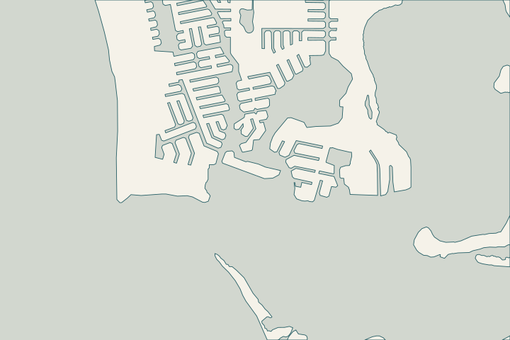
Get to know your waterfront
The city plan identifies Caxambas Bay, and its bridge brochure places Caxambas Court at Roberts Bay. NOAA also maintains a historical datum sheet for Marco Island’s Caxambas Pass station. Nearby, FWC designates a Caxambas Pass Critical Wildlife Area with a seasonal closure. These sources help locate the planning issues, but none establishes a private parcel’s design elevation, barge permission or construction approval.
Marco Island comprehensive plan and map series · Marco Island bridge and waterway reference · NOAA Caxambas Pass benchmark sheet · FWC Caxambas Pass CWA · City seawall permit application — Form 31
Ask for the wall’s measured reference, not its height above water
The city requires NAVD88 cap elevation on the completion survey. Water visible against the wall changes, so a photograph or a measurement from the waterline cannot replace that surveyed reference. The NOAA station sheet uses historical observations, not live conditions.
Have the professional inspect the water-side condition and the submerged toe where the scope requires it. Access and any posted wildlife boundaries should be considered before mobilization.
What could the work cost?
Include survey work, underwater access and the actual barge route. If staging or operations near posted protected areas affect the sequence, the contractor should explain the allowance and permission required.
Published regional starting prices. Get a written quote for the work at your property.
Compare quotes and plan a budget →Find the relevant permits and records
| Starting point | What to resolve | Prepare and look up |
|---|---|---|
Marco Island · Building Services | Confirm Form 31 scope, current fees and required related permits. | Address, survey, lot and waterway widths, engineered drawings and staging description. Call 239-389-5059. |
DEP South District | Ask about environmental authorization, submerged lands and vegetation for this work. | Site plan, photos, equipment route and proposed waterward work. Call 239-344-5600. |
USACE · Fort Myers | Confirm federal review for the proposed waterfront activity. | Describe location, dimensions and the complete work footprint. Call 239-334-1975. |
Caxambas & the Estates: the practical checklist
Use these checks to turn the location into a defined scope and a clear question for the responsible professional.
Confirm the Roberts Bay route
Check whether the Caxambas Court crossing is on the approach and have the operator verify current clearance conditions.
Marco Island bridge and waterway reference · City bridge locations and clearance brochure
Use compatible elevation references
Copy the survey’s top-of-cap elevation with its datum. Do not use NOAA’s historical tide sheet as a live observation or universal conversion.
City seawall permit application — Form 31 · NOAA Caxambas Pass benchmark sheet · NOAA datum FAQ
Respect the designated wildlife area
FWC lists April 1–August 31 closure dates; follow posted boundaries and restrictions on vessel landings. The restriction is not a blanket closure of all nearby private waterfront.
Organize your Caxambas & the Estates project
Keep the parcel location, observed changes and available records with your project notes. When you send the form, we pass your request to a local marine contractor.
Help understanding your seawall, exploring repair options and finding the right next step.
Caxambas & the Estates project questions
Does the Caxambas tide station show today’s level?
The datum sheet referenced here is historical, based on a 1976–1979 series and a named tidal epoch. It is not a live reading.
Does the wildlife closure prohibit every local seawall project?
No. It applies to the designated area and posted restrictions. Confirm the proposed route and work limits with the relevant authorities.
Keep planning
Nearby waterfront guides
Show sourcesHide sources
- Marco Island comprehensive plan and map seriesSource reviewed 2026-10-25
- Marco Island bridge and waterway referenceSource reviewed 2026-10-25
- NOAA Caxambas Pass benchmark sheetSource reviewed 2026-10-25
- FWC Caxambas Pass CWASource reviewed 2026-10-25
- City seawall permit application — Form 31Source reviewed 2026-10-25
- Marco Island Building ServicesSource reviewed 2026-10-25
- Signed Resolution 26-26: building permit feesSource reviewed 2026-10-25
- DEP South District PermittingSource reviewed 2026-10-25
- DEP mangrove questionsSource reviewed 2026-10-25
- USACE regulatory office locationsSource reviewed 2026-10-25 · official indexed text
- NOAA datum FAQSource reviewed 2026-10-25
- Marco Island Seawall Owner’s Manual (April 2014)Source reviewed 2026-10-25
- Historical city seawall code packet (2018)Source reviewed 2026-10-25
- Collier County marine submittal requirementsSource reviewed 2026-10-25 · official indexed text