
Barfield Bay & Key Marco Seawall Planning
Define the permitted shoreline and proposed work footprint first. Bay-facing access and vegetation can make this a different problem from a narrow canal repair.
Describe your project on this page ↓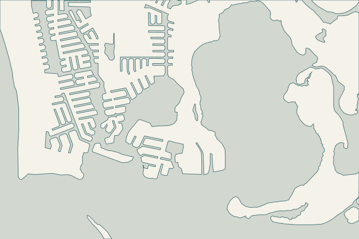
Get to know your waterfront
The city comprehensive-plan maps identify Barfield Bay and Key Marco on the island’s southeastern side. DEP’s regional material places the surrounding waters in a broader estuarine and aquatic-preserve context. This does not establish one regulatory boundary for every lot. Use a parcel survey and current agency maps to locate the existing structure, mangroves and proposed equipment or rock placement.
Marco Island comprehensive plan and map series · DEP Southwest Gulf Coast beach management plan · Rookery Bay reserve management plan 2022–2027 · DEP mangrove questions · DEP South District Permitting
Document the waterward work limit and vegetation
Photograph mangroves, the existing wall and the intended access area before arranging clearing. DEP advises district contact before relying on an exemption for vegetation affecting a seawall. Include any proposed change in the footprint.
If riprap or a new alignment is proposed, ask about submerged-land authorization and federal review. A historical city code packet is not sufficient confirmation of today’s permitted setback or cap height.
What could the work cost?
Require separate descriptions of structural work, environmental review and access. Do not treat vegetation removal, rock placement or use of a nearby shoreline as an assumed incidental allowance.
Published regional starting prices. Get a written quote for the work at your property.
Compare quotes and plan a budget →Find the relevant permits and records
| Starting point | What to resolve | Prepare and look up |
|---|---|---|
Marco Island · Building Services | Confirm Form 31 scope, current fees and required related permits. | Address, survey, lot and waterway widths, engineered drawings and staging description. Call 239-389-5059. |
DEP South District | Ask about environmental authorization, submerged lands and vegetation for this work. | Site plan, photos, equipment route and proposed waterward work. Call 239-344-5600. |
USACE · Fort Myers | Confirm federal review for the proposed waterfront activity. | Describe location, dimensions and the complete work footprint. Call 239-334-1975. |
Barfield Bay & Key Marco: the practical checklist
Use these checks to turn the location into a defined scope and a clear question for the responsible professional.
Locate the proposal on the survey
Show the existing wall, intended work limits and neighboring structures with the site information required by the city.
Ask DEP with photographs
Discuss mangrove alteration, submerged lands and the actual access route with South District before relying on a claimed exemption.
DEP mangrove questions · DEP mangrove trimming and removal · DEP South District Permitting
Coordinate the federal question
USACE’s Fort Myers Permits Section covers Collier County. Describe the complete waterward activity and retain its determination.
Organize your Barfield Bay & Key Marco project
Keep the parcel location, observed changes and available records with your project notes. When you send the form, we pass your request to a local marine contractor.
Help understanding your seawall, exploring repair options and finding the right next step.
Barfield Bay & Key Marco project questions
Does being near Rookery Bay make every lot part of the reserve?
No. DEP distinguishes Marco Island from the surrounding reserve. Verify the actual boundary and proposed work with the authority.
Can mangroves be cleared to get a barge to the wall?
Access needs do not create blanket removal permission. Send the location, photos and proposed activity to DEP for guidance.
Keep planning
Nearby waterfront guides
Show sourcesHide sources
- Marco Island comprehensive plan and map seriesSource reviewed 2026-10-25
- DEP Southwest Gulf Coast beach management planSource reviewed 2026-10-25
- Rookery Bay reserve management plan 2022–2027Source reviewed 2026-10-25
- DEP mangrove questionsSource reviewed 2026-10-25
- DEP South District PermittingSource reviewed 2026-10-25
- Marco Island Building ServicesSource reviewed 2026-10-25
- City seawall permit application — Form 31Source reviewed 2026-10-25
- Signed Resolution 26-26: building permit feesSource reviewed 2026-10-25
- USACE regulatory office locationsSource reviewed 2026-10-25 · official indexed text
- Marco Island Seawall Owner’s Manual (April 2014)Source reviewed 2026-10-25
- Historical city seawall code packet (2018)Source reviewed 2026-10-25
- Collier County marine submittal requirementsSource reviewed 2026-10-25 · official indexed text